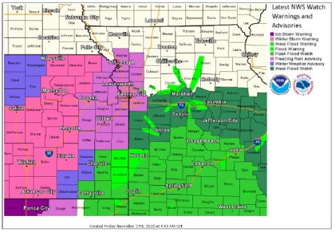
A freezing rain advisory is in effect for Wyandotte County, eastern Kansas and northwestern Missouri through Saturday morning, according to the National Weather Service.
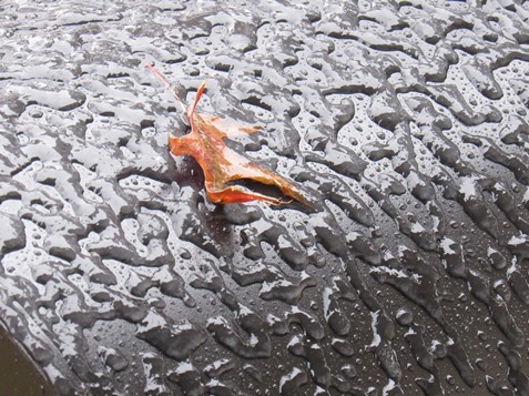
It is in effect until 6 a.m. Saturday, the weather service said. A light glaze of ice could be seen in places in Wyandotte County on Friday morning.
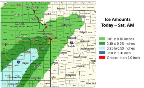
Light glazing is possible across north-central and northwestern Missouri including the KC metro area with ice accumulations up to a tenth of an inch possible across eastern Kansas.
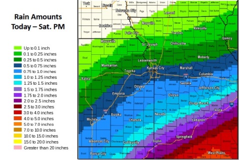
An additional half-inch to 1.5-inch or rain will be possible today across central Missouri and east-central Kansas on top of the 2 to 3 inches that fell yesterday, which may lead to area flooding. As such a flood watch remains in effect until midnight in central Missouri and east central Kansas.
It was 33 degrees in parts of Wyandotte County at 9 a.m., according to the weather service.
The freezing rain is forecasted to pick up in intensity by mid-to-late morning, then taper off late this evening. Some sleet could mix in off and on throughout the day, the weather service said.
The weather service said ice accumulation is possible on elevated surfaces such as bridges, power lines and trees. Weak tree branches could break under the weight of the ice, and any untreated sidewalks and road surfaces will become slick, according to the weather service.
Residents should be prepared for travel difficulties and slippery roads, the weather service said. Resident should slow down and use caution if driving.
Today’s high will hover at the freezing mark, with the high expected near 32, according to the weather service. Freezing rain and sleet are expected mainly before 4 p.m. The north wind will be 13 to 15 mph, with gusts as high as 22 mph.
Tonight, there is a 40 percent chance of freezing rain and sleet before 7 p.m., then a chance of rain, freezing rain and sleet between 7 p.m. and 10 p.m., followed by a chance of freezing rain and sleet after 10 p.m., according to the weather service. The low will be around 31. A north northwest wind of 11 to 13 mph is predicted.
Saturday, there will be a 30 percent chance of rain or freezing drizzle before 9 a.m., then a chance of rain, the weather service said. The high will be near 35. A north northeast wind of 8 to 11 mph is predicted.
Saturday night, there is a 50 percent chance of rain. The low will be around 33, and there will be a north northeast wind of 7 to 10 mph, the weather service said.
On Sunday, the high will be 39 and there will be a 50 percent chance of rain, according to the weather service. There will be a north northeast wind of 6 to 8 mph.
Sunday night, the low will be 35, with a 60 percent chance of rain, the weather service said.
Monday, the high will be near 42 with a 60 percent chance of rain, according to the weather service.
Monday night, there will be a low of 30.
For more weather information, visit www.weather.gov.