Periods of rain are expected through the day Thursday, with the potential for a line of storms to develop later in the afternoon and evening as a cold front moves through, according to the National Weather Service.
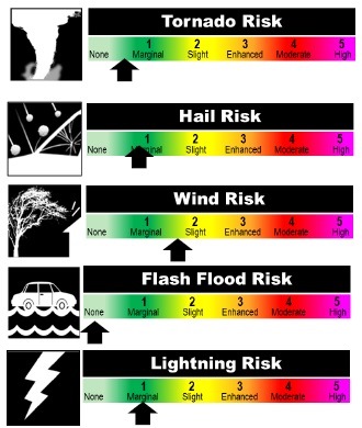
A few storms could produce strong winds, but the overall threat for severe storms is low, the weather service said.
Today’s forecast is patchy fog before 9 a.m., then gradually becoming mostly sunny with a high near 71, according to the weather service. There will be a south wind of 9 to 13 mph.
Tonight, it will be mostly cloudy, with a low of 59, and a south wind of around 11 mph, the weather service said.
On Thursday, there is a 60 percent chance of showers, with a thunderstorm possible, according to the weather service. It will be cloudy with a high near 68. A south wind will be 11 to 15 mph, with gusts as high as 22 mph, the weather service said.
Thursday night, there is a 60 percent chance of showers before midnight, the weather service said. It will be cloudy during the early evening, then gradually clearing, with a low around 45, according to the weather service. There will be a south southwest wind of 6 to 11 mph becoming northwest after midnight.
Friday, expect sunny skies and a high of 59, according to the weather service. A west northwest wind of 5 to 7 mph will become light and variable in the afternoon.
Friday night, skies will be partly cloudy with a low around 40, the weather service said.