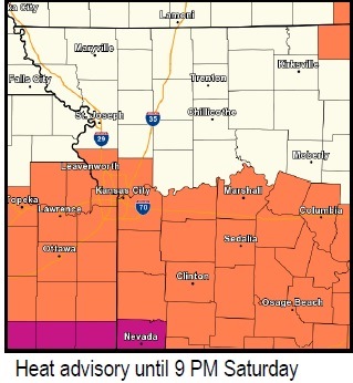
A heat advisory is in effect until 9 p.m. Saturday, July 25, in Wyandotte County, according to the National Weather Service.
Also, an air quality alert has been issued by the Mid-America Regional Council, and it is an orange ozone day.
Today, the high may reach 93 and the heat index may reach 103 in Wyandotte County, according to the weather service.
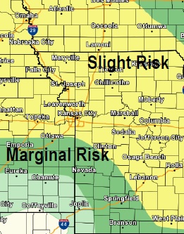
Strong to severe thunderstorms are possible after 4 p.m. Saturday, the weather service said. Damaging winds and very heavy rainfall are the primary threats. Flash flooding is possible in some areas, according to the weather service.
The low will be 75 tonight, and there is a 50 percent chance of showers and storms.
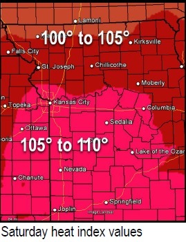
Sunday, the high will be near 94, and the heat index could reach 106. There is a 30 percent chance of storms and rain on Sunday.
Hot and humid weather will continue Sunday into Tuesday, and additional heat advisories or warnings could be issued later, according to the weather service.
On the orange ozone alert days, individuals and businesses are asked to avoid activities that lead to ozone formation from 10 a.m. to 7 p.m. These activities include refueling vehicles or topping off when refueling idling vehicles, and using gasoline-powered lawn equipment. Instead, MARC suggests that people carpool, bike to work, delay or combine errands, and use water-based paints and cleaners.
For more weather information, visit www.weather.gov/kc.