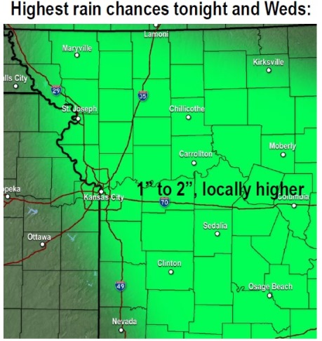
After a warm, sunny day, Wyandotte County could see thunderstorms tonight into early Wednesday morning, according to the National Weather Service.
Today’s high will be 91 degrees, the weather service said, with a heat index possibly approaching 100 degrees but staying under the century mark.
There is a 50 percent chance of thunderstorms tonight, the weather service said.
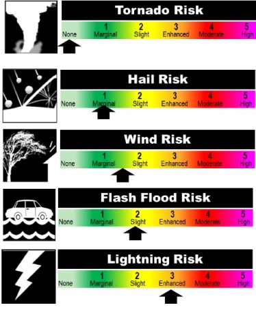
Some storms could produce heavy rainfall and local flooding, according to the weather service. A few storms could be strong to severe with large hail and damaging winds, the weather service said. The weather service does not expect tornadoes with this storm.
Additional thunderstorms Wednesday afternoon and evening may produce locally heavy rainfall, with the highest chances to the south of the Missouri River, the weather service said.
Occasional storm chances will persist into the holiday weekend, according to the weather service. At this time it’s too early to determine if any of these storms may be strong or produce flooding.
At this time, the forecast for Saturday, the Fourth of July, includes a 30 percent chance of showers and thunderstorms, with a high near 83. The day will be mostly sunny. The Saturday night forecast is partly cloudy, with a low of 70.