Heat and humidity return both today and Thursday, according to the National Weather Service.
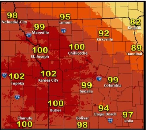
Heat index values will range from 95 to 102 today; and 95-102 south of the Missouri River on Thursday.
Several rounds of storms with heavy rain possible Thursday night into Friday, the weather service said.
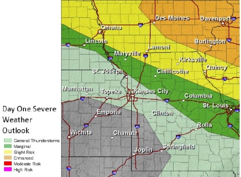
Isolated severe storms will be possible north of Route 36, to the north of the Kansas City area, early Thursday morning.
With a high of near 95 in Wyandotte County today, combined with high humidity, there will be a heat index of 100 or above this afternoon, according to the weather service.
Residents are advised to stay in air-conditioning this afternoon. Never leave children or pets unattended in a vehicle, not even for a minute, the weather service said.
Tonight, the low will be around 77, with south southwest wind around 16 mph, gusting to 24 mph, according to the weather service.
Thursday, the high will be 89 with a heat index as high as 97. There will be a 30 percent chance of showers and thunderstorms Thursday, the weather service said.
Thursday night, expect a 70 percent chance of showers and thunderstorms, with a low of 72, according to the weather service.
There is a 60 percent chance of showers and thunderstorms on Friday, the weather service said. The high will be near 79.