Multiple rounds of heavy rain are possible through the weekend and into early next week with thunderstorms likely throughout the next five days, according to the National Weather Service.
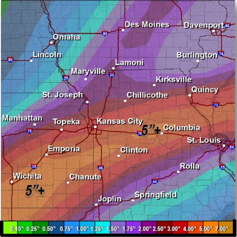
Widespread 2.5-inch amounts of rain are likely with some areas seeing up to 5-inch amounts, according to the weather service.
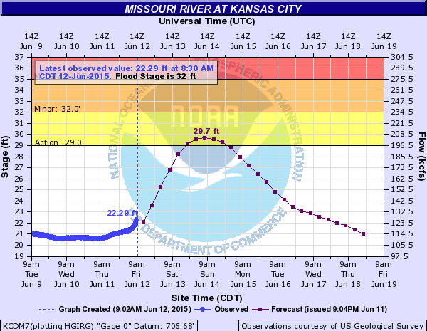
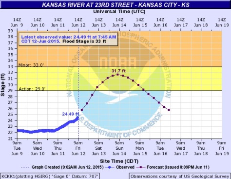
Flash flooding is possible and river flooding will be exacerbated, according to the weather service.
The threat for severe thunderstorms is low through the weekend and into early next week, the weather service said.
Today, the high will be near 78 with a 50 percent of rain. It was 70 degrees at 9 a.m.
Tonight’s low will be around 67, with a 70 percent chance of rain, the weather service said.
Saturday, expect a high near 79 with a 60 percent chance of rain.
For more weather information, visit www.weather.gov.