Some rain has moved through Wyandotte County, and storm clouds are moving through the region this morning.
Most of this storm is located to the north of Wyandotte County, according to radar maps from the National Weather Service.
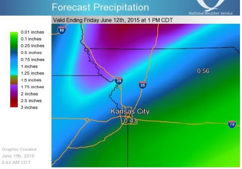
Thunderstorms this morning will continue to push off toward the east with a break in the precipitation midday today, according to the weather service.
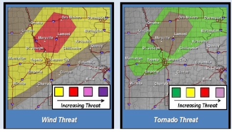
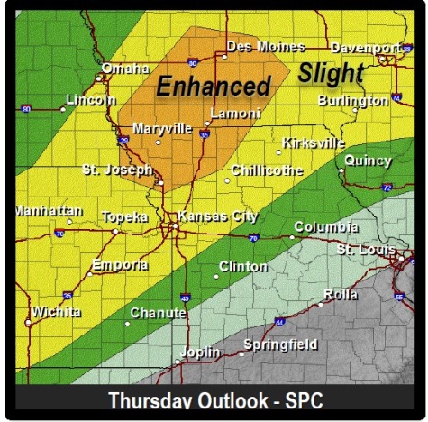
Another round of thunderstorms will develop later this afternoon, bringing the potential for strong to severe weather from western Kansas through northern Missouri, with a slight risk in Wyandotte County and an enhanced risk.to the north, near St. Joseph, Mo., according to the weather service.
The storm this afternoon will bring the potential of tornadoes, hail, damaging winds and flash flooding, the weather service said.
Today’s temperatures may reach 90 degrees, with a heat index of 95, according to the weather service.
Tonight, showers and thunderstorms are likely between 10 p.m. and 4 a.m. The chance of rain is 70 percent. The low tonight will be 65.
Friday, expect a 40 percent chance of showers and storms, with a high near 76, the weather service said.
Friday night, there is a 60 percent chance of showers and thunderstorms. The low will be 66.
On Saturday, the high will be near 79, with a 70 percent chance of shower s and thunderstorms. Saturday night, the low will be around 69, with showers and thunderstorms in the forecast.
Showers and thunderstorms also are in the forecast from Sunday through Wednesday.