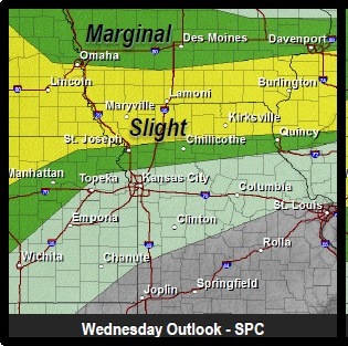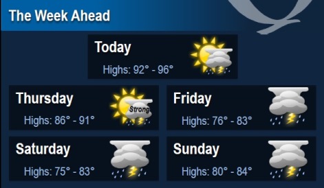
Top two weather concerns for today will be the possibility of thunderstorms popping up across the northern part of the region, with the potential for some of them to become strong to severe. The second weather concern will be the heat indices climbing into the upper 90s to lower 100s, the National Weather Service said.
As the region enters back into an active weather pattern, moderate to heavy rainfall could cause flooding problems once again over the upcoming weekend, according to the weather service.
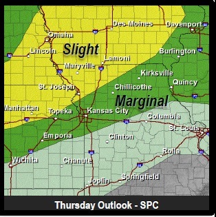
Primary hazards for storms today will be dangerous cloud-to-ground lightning, gusty to damaging winds, and hail (possibly large), the weather service said. Note that while the tornadic threat is low, it isn’t null due to a boundary draping across the area later today. Similar hazards exist for tomorrow as well.
The heat index in Wyandotte County today could hit 100, the weather service said. The temperature may reach 94 on this sunny day. A southwest wind of around 11 mph is predicted.
The temperature was 84 at 9 a.m., with a heat index of 87, according to the weather service.
Today’s SkyCast is yellow or moderate, which means there is an elevated ozone concentration and unusually sensitive people should consider limiting prolonged outdoor exertions, according to the Mid-America Regional Council. (www.marc.org/Environment/Air-Quality/SkyCast/About)
Tonight, expect a low of 73, according to the weather service.
Thursday, there is a 30 percent chance of showers and thunderstorms, with a high near 89. A south wind of 9 to 18 mph may gust up to 26 mph.
For more weather information, visit www.weather.gov.