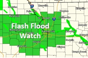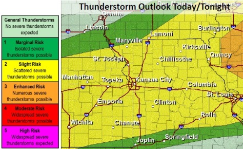
Wyandotte County is under a flash flood watch from 4 p.m. Sunday, June 7, until 7 a.m. Monday, June 8, according to the National Weather Service.
The temperature was 87 degrees at 11 a.m. in Wyandotte County. Today, there is a 50 percent chance of showers and storms after 3 p.m., according to the weather service. More showers and storms are possible after 7 p.m. There is a 70 percent chance of precipitation tonight, the weather service said.
The weather service said a weak cold front is moving into the area late this morning into the afternoon, and scattered storms are possible along and just behind the boundary.
A few of the storms may be severe, with large hail and damaging wind gusts the primary hazards. The most probable time for severe weather will be between 3 p.m. to midnight, according to the weather service.
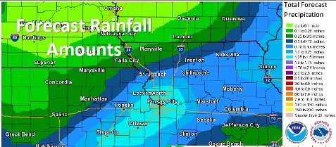
Thunderstorms will have the potential to produce heavy rainfall in a short period of time this afternoon into tonight, the weather service said.
Some areas may see repeated rounds of thunderstorms.
With already saturated soils, the potential for flash flooding exists with the most robust activity. A flash flood watch is in effect through Monday morning.
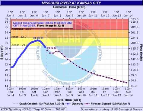
The rainfall from the last several days has led to widespread flooding along area rivers and low-lying areas.
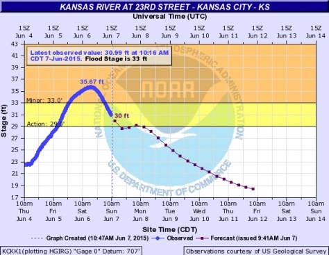
The Kansas River in Kansas City, Kan., was in minor flood stage on Saturday. On Sunday, the river has begun receding below flood stage.
In the event of water on the roadway, the weather service advised motorists to turn around and seek a different, not to try to go through it.
To get the latest on river flooding, go to the website: http://water.weather.gov/ahps2/index.php?wfo=eax.
