After a morning storm that included heavy rain, winds and lightning, today’s weather still has some rain and storms possible, according to a National Weather Service forecast.
While skies over Wyandotte County currently are clearing, there is light rain to the southwest of the metropolitan area that could be moving toward the Kansas City area, according to a radar map.
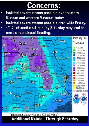
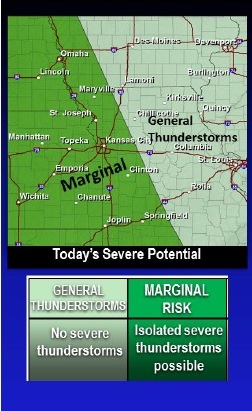
Area-wide thunderstorms also will be possible Friday with the potential for isolated severe storms capable of producing damaging winds and hail, the weather service said.
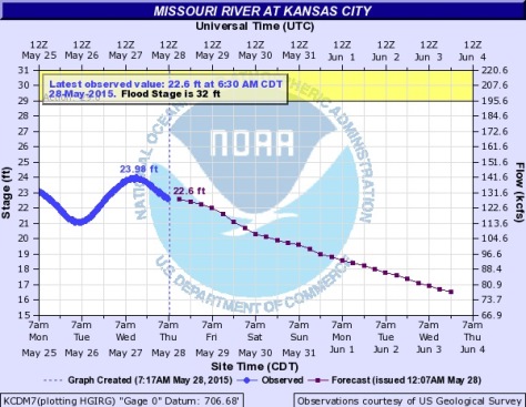
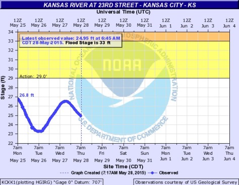
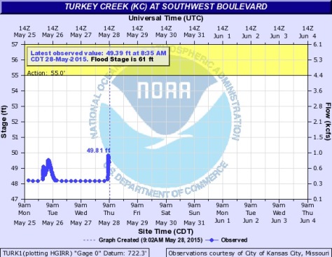
An additional 1 to 2 inches of rain will be possible by Saturday, which may prolong ongoing flooding and lead to additional flooding along area rivers, creeks and streams, according to the weather service.
Today’s high should be near 81 degrees. Tonight, there is a 50 percent chance of rain, with a low around 67, the weather service said.
Friday, expect a high near 78, with a 60 percent chance of rain, according to the weather service. Friday night, there is a 70 percent chance of rain with a low of 61.
Rain is not in the forecast for Saturday, Sunday, Monday and beyond.
Saturday, there is a high predicted of 70, with mostly cloudy skies. Sunday’s forecast is mostly sunny with a high of 69, according to the weather service.