Widespread rain overnight and today was expected to range from a half-inch to more than 1 inch for many areas, according to the National Weather Service.
In some areas, the rain would prolong current flooding, but not induce new flooding, along area streams, creeks and some rivers, the weather service said.
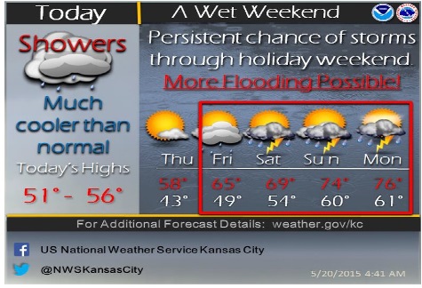
Thunderstorms are possible Friday night through Monday, according to the weather service. It is too early to determine if the storms will be severe, but the potential to produce heavy rainfall likely will lead to new flooding, the weather service said.
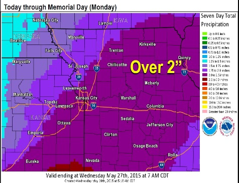
A weather graphic from the weather service stated it is possible for more than 2 inches of rain to fall in Kansas City, Kan., through Memorial Day.
While there is a chance of rain in the area through the morning, Wednesday afternoon is clearing, with mostly cloudy skies in the forecast this afternoon, according to the weather service.
A glance at the hydrology charts for the Missouri River at Kansas City, the Kansas River at 23rd Street in Kansas City, Kan., and Turkey Creek at Southwest Boulevard showed that none of them are at the action stage, and are considerably below flood stage on Wednesday morning.
Thursday, the skies will be mostly sunny with a high near 65. Friday, there is a 30 percent chance of rain after 1 p.m. The high will be near 67.
Rain continues in the forecast each day from Friday through Tuesday, according to the weather service.
For more weather information, visit www.weather.gov.