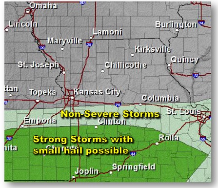
It appears that thunderstorms may hit the general region, but could miss Wyandotte County today.
The National Weather Service’s storm map shows the storms close, but located to the south of Wyandotte County for this afternoon and evening.
Today’s weather in Wyandotte County will be sunny with a high near 66, a west southwest wind 8 to 16 mph with gusts as high as 28 mph. Tonight, it will be partly cloudy with a low around 40, and a west wind of 6 to 13 mph becoming north after midnight.
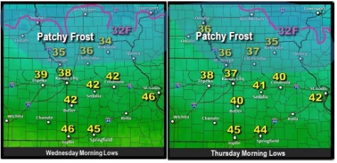
Wednesday, expect a high of 58 with sunny skies, according to the weather service. Wednesday night’s low will be around 39. There could be some patchy frost in northern Kansas and Missouri on Wednesday and Thursday morning, according to the weather service, although this could be north of Wyandotte County.
The weather service said Thursday will be mostly sunny with a high of 64 and a southeast wind of 3 to 8 mph. Thursday night’s low will be 49.
Next chance for storms is Friday afternoon through Friday night, but there is a question about whether they will be severe, the weather service said.
The high will be near 63, and the chance of showers and thunderstorms is 60 percent mainly after 1 p.m. Friday, according to the weather service.