Some rain and storms moved through the area this morning, and there may be a second round of thunderstorms later today, according to the National Weather Service.
The second round of thunderstorms may form by mid-afternoon the region and then move east during the early evening.
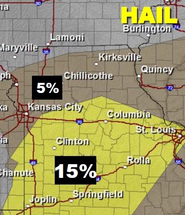
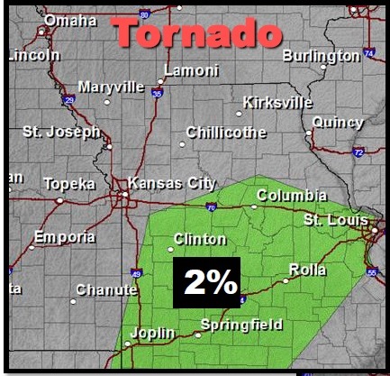
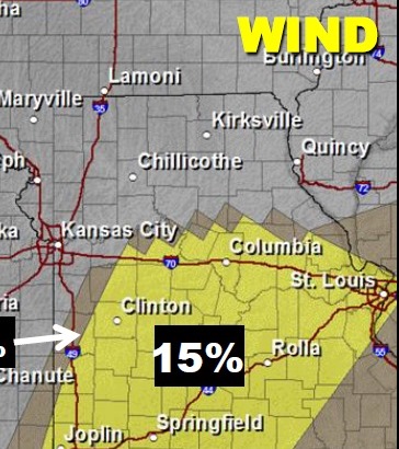
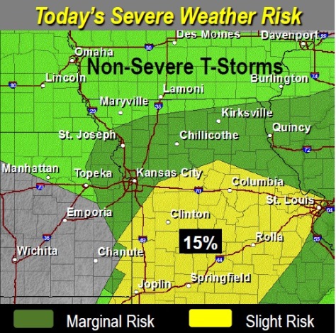
Strong to severe thunderstorms are possible, with the greatest threat east of I-35 and south of I-70.
The primary severe threats to this storm are large hail, damaging winds and dangerous cloud-to-ground lightning, according to the weather service.
Weather service forecast maps showed that Wyandotte County is to the north of the worst part of this strong storm.
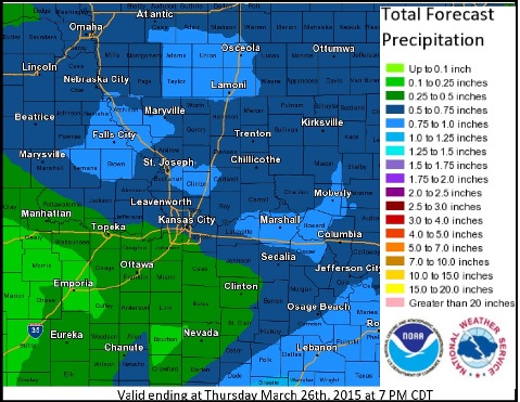
The forecast gave a 50 percent chance of rain Tuesday, and the high will be near 53, according to the weather service forecast.
Tonight, there is a 20 percent chance of rain, with a low around 41, the weather service said.
Wednesday, expect a 30 percent chance of showers and thunderstorms after 1 p.m., the weather service said. The high will be near 64 Wednesday. The low on Wednesday night will be around 35, according to the weather service.
Rain is not in the forecast for the rest of the week.
Those who have already planted gardens should take note that Thursday night’s predicted low is around 30 degrees, and Friday night’s low is around 31. Daytime highs for Thursday and Friday are 51 and 46.
Saturday’s high will be 52, and Sunday’s 69, according to the weather service. The lows will be 40 on Saturday night and 42 on Sunday night.