Thursday’s forecast includes a 40 percent chance of showers and thunderstorms, mainly after noon.
Skies will be cloudy with a high near 64 on Thursday.
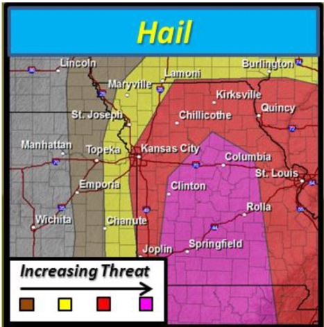
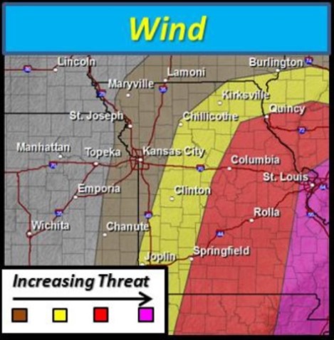
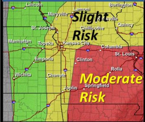
According to the National Weather Service, Wyandotte County is under a slight risk for severe weather today, while an area of central Missouri is under a moderate risk.
This severe weather between 1 p.m. and 6 p.m., contains a higher risk of tornadoes, large hail and severe weather in central Missouri. Storms should move out of the region by 9 p.m. and midnight.
Tonight brings a 20 percent chance of thunderstorms before 10 p.m. in Wyandotte County, then a slight chance of showers between 10 p.m. and 1 a.m. The weather will turn windy with 17 to 21 mph wind speeds and gusts up to 29 mph.
Friday’s weather wlll be mostly sunny, with a high near 50. The breezy weather continues with winds from 18 to 22 mph, with gusts as high of 30 mph.