Freezing drizzle and light rain is expected to develop late this afternoon and evening, changing over to a wintry mix overnight, the National Weather Service said.
The wintry mix will make a transition to all snow by Saturday morning, the weather service stated.
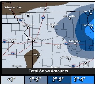
While snow amounts and locations are somewhat uncertain at this time, the Kansas City area is expected to receive less than an inch of snow, according to the weather service. Some ice is also possible through midday Saturday.
Colder temperatures will move in Saturday night and Sunday morning with lows in the single digits to low teens, and Sunday highs in the teens and lower 20s.
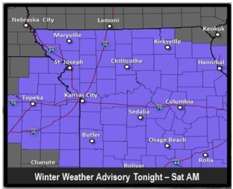
A winter weather advisory has been issued from 4 p.m. today through 10 a.m. Saturday morning for a mix of freezing drizzle, freezing rain and snow.
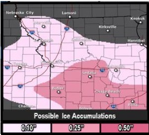
Ice accumulations of greater than one-tenth of an inch is possible along and south of I-70, with lower amounts to the north, the weather service said.
The weather service warned residents to be prepared for slippery roads and limited visibility and to use caution when driving.