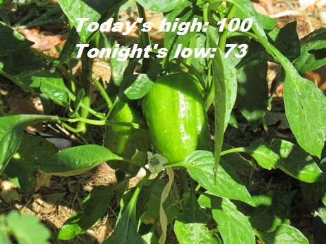
Look for a high near 100 today in Wyandotte County, according to the National Weather Service forecast.
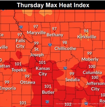
While it will be hot today, the lack of humidity will keep the heat index in check with readings near the air temperature, the weather service said.
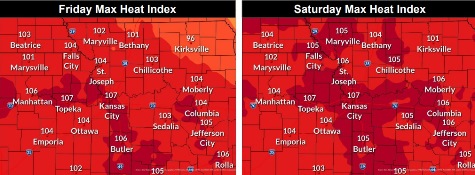
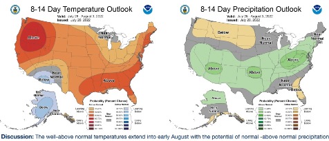
Well above normal temperatures will continue into the weekend, the weather service said.
On Friday and Saturday, the heat index could reach as high as 105, according to the weather service.
Surface high pressure is gradually shifting to the east today with winds becoming more southwesterly by this evening, the weather service said.
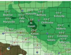
Moisture will transfer up from the Gulf on Friday and dewpoints will slowly increase Friday afternoon. The heat index then will increase, perhaps resulting in heat advisories for Friday or Saturday.
On Sunday, a cold front will push through during the day, with the high near 98 in Wyandotte County, according to the weather service. There will be a 50 percent chance of showers on Sunday night.
Today, it will be sunny and hot, with a high near 100 and a southwest wind of 3 to 7 mph, the weather service said.
Tonight, it will be mostly clear, with a low of 73 and a southwest wind of 5 mph becoming light and variable, according to the weather service.
Friday, it will be sunny and hot, with a high near 101 and a heat index as high as 105, the weather service said. A southeast wind of 5 to 11 mph will become south southwest in the afternoon, and winds may gust up to 20 mph.
Friday night, it will be mostly clear, with a low of 78 and a south southwest wind of 7 to 10 mph, gusting as high as 18 mph, according to the weather service.
Saturday, it will be sunny and hot, with a high near 101, the weather service said. A south southwest wind of 7 to 14 mph will gust as high as 28 mph.
Saturday night, there is a 20 percent chance of showers and thunderstorms after 1 a.m., according to the weather service. The low will be around 81.
Sunday, it will be mostly sunny and hot, with a high near 98, the weather service said.
Sunday night, there is a 50 percent chance of showers and thunderstorms after 1 a.m., with a low of 73, according to the weather service.
Monday, there is a 30 percent chance of showers before 1 p.m., with a high near 89, the weather service said.
Monday night, there is a 40 percent chance of showers and thunderstorms after 1 a.m., with a low of 74, according to the weather service.
Tuesday, there is a 30 percent chance of showers, with a high near 96, the weather service said.
Tuesday night, there is a 40 percent chance of showers, with a low of 75, according to the weather service.
Wednesday, there is a 30 percent chance of showers, with a high near 92, the weather service said.