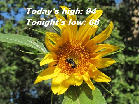
A slight break from the very high heat is in today’s forecast, which calls for a high of 94, according to the National Weather Service.
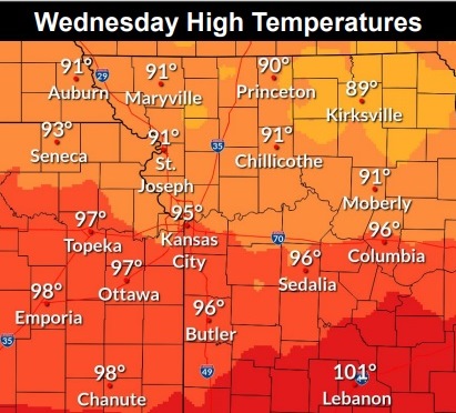
The heat will increase through the week and weekend, with the heat index in the 90s Wednesday and rising into the 100s for Thursday through Saturday, and reaching the 100s again next week.
The next chance for rain will come Sunday through Monday, the weather service said.
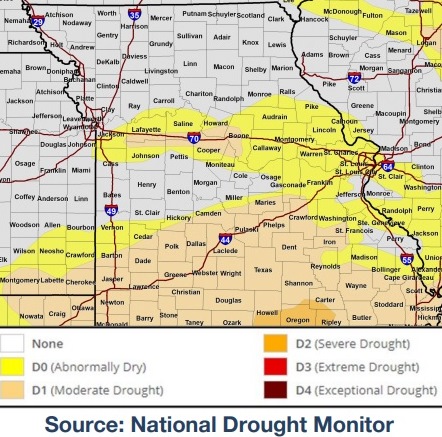
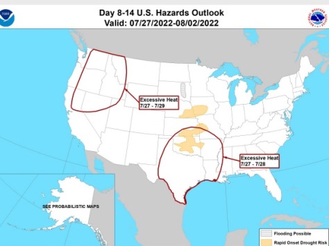
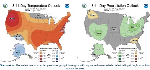
According to the weather service, moderate drought conditions exist along I-70, and fire weather concerns are gradually increasing in the region as hot and dry conditions continue.
The excessive heat risk later this week and early next week, combined with dry conditions, also could lead to rapid development of drought conditions for portions of the region, the weather service said.
Heat will build back in on Thursday and continues through the weekend, according to the weather service. There are a few chances for showers and storms late this week and into the weekend.
A front has pushed just south of the southern forecast area early this morning, with temperatures cooling into the 70s, the weather service said.
Temperatures fell into the lower 70s this morning, and breezy north winds will help keep daytime temperatures today slightly cooler behind the front, and with lower dewpoints, the heat index will stay below 100 degrees today, according to the weather service.
The cooldown will not last long as temperatures climb back into the mid 90s to near 100 Thursday afternoon, the weather service said. Lower dewpoints will help keep the heat index in check. Areas south of the Missouri River may see heat index values of 100 to 104 on Thursday, with areas north of the river staying below 100, according to the weather service.
Today, it will be sunny, with a high near 94 and a north northwest wind of 8 to 10 mph, gusting as high as 18 mph, the weather service said.
Tonight, it will be clear, with a low of 68 and a north northwest wind of 5 to 7 mph, becoming calm in the evening, according to the weather service
Thursday, it will be sunny and hot, with a high near 101 and a southwest wind of 3 to 8 mph, the weather service said.
Thursday night, it will be mostly clear, with a low of 74 and a calm wind becoming south around 5 mph after midnight, according to the weather service.
Friday, it will be mostly sunny and hot, with a high near 101, the weather service said. A south southwest wind of 5 to 11 mph will gust as high as 25 mph.
Friday night, it will be mostly clear, with a low of 79, according to the weather service.
Saturday, it will be sunny and hot, with a high near 103, the weather service said.
Saturday night, it will be mostly clear, with a low of 78, according to the weather service.
Sunday, it will be mostly sunny, with a high near 96, the weather service said.
Sunday night, there is a 40 percent chance of showers, with thunderstorms also possible after 1 a.m., according to the weather service. It will be mostly cloudy, with a low of 73.
Monday, there is a 30 percent chance of showers, with a high near 95, the weather service said.
Monday night, there is a 30 percent chance of showers, with a low of 75, according to the weather service.
Tuesday, it will be mostly sunny and hot, with a high near 100, the weather service said.