Dangerous heat is in the forecast through 8 p.m. Wednesday, according to the National Weather Service.
Wyandotte County is under a heat advisory through 8 p.m. June 15.
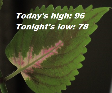
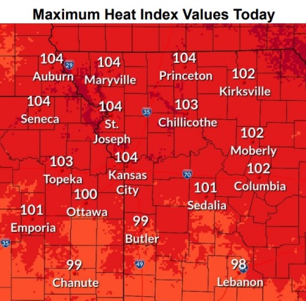
Tuesday’s high will be near 96 with a heat index as high as 104, the weather service said. At 9 a.m., the temperature was 85.
With overnight lows above 75 degrees, it will be difficult to recover from daytime heat, according to the weather service.
Breezy conditions are expected Tuesday, with a south southwest wind of 21 mph gusting to 41 mph, the weather service said.
Residents are advised to drink plenty of fluids, stay in an air-conditioned room, stay out of the sun and check on relatives and neighbors, according to the weather service. Young children and pets should never be left unattended in vehicles.
Take extra precautions if you work or spend time outdoors, according to the weather service. When possible reschedule strenuous activities to early morning or evening.
Wear lightweight and loose-fitting clothing when possible. In outdoor work, the Occupational Safety and Health Administration recommends scheduling frequent rest breaks in shaded or air conditioned environments. Anyone overcome by heat should be moved to a cool and shaded location. Heat stroke is an emergency; residents can call 911.
Today, it will be sunny, with a high near 96 and heat index values as high as 104, the weather service said. It will be breezy, with a south southwest wind of 21 mph, gusting as high as 41 mph.
Tonight, it will be partly cloudy, with a low of 78 and a south wind of 14 to 16 mph, gusting as high as 28 mph, according to the weather service.
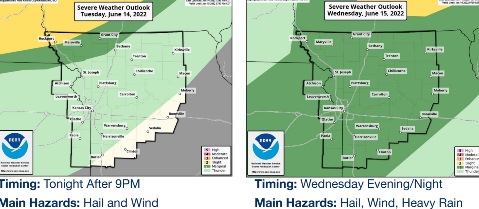
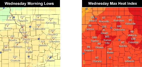
Wednesday, there is a 30 percent chance of showers and thunderstorms after 1 p.m., with a high near 94, the weather service said. The heat index will be as high as 102. It will be breezy, with a south wind of 16 to 20 mph, gusting as high as 29 mph. Less than a tenth of an inch of rain is possible.
Wednesday night, there is a 40 percent chance of showers and thunderstorms before 1 a.m., according to the weather service. The low will be around 70 with a southwest wind of 8 to 13 mph becoming light south in the evening. Winds may gust as high as 18 mph. Between a quarter and half-inch of rain is possible.
Thursday, there is a 20 percent chance of showers and thunderstorms after 1 p.m., the weather service said. The high will be near 94 with a calm wind becoming south around 6 mph in the morning.
Thursday night, there is a 30 percent chance of showers and thunderstorms, with a low of 73, according to the weather service.
Friday, it will be sunny, with a high near 93, the weather service said.
Friday night, it will be mostly clear, with a low of 71, according to the weather service.
Saturday, it will be sunny, with a high near 95, the weather service said.
Saturday night, it will be clear, with a low of 70, according to the weather service.
Sunday, it will be sunny, with a high near 96, the weather service said.
Sunday night, it will be clear, with a low of 73, according to the weather service.
Monday, it will be sunny and hot, with a high near 97, the weather service said.