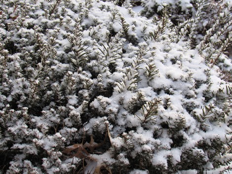
Snow has ended in Wyandotte County on Monday morning, but slick spots may still remain on area roads and highways.
Little to no accumulation is in the forecast for the rest of Monday.
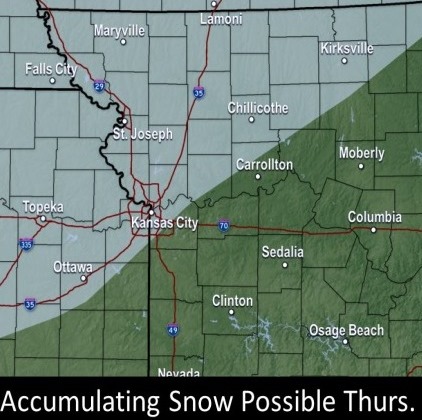
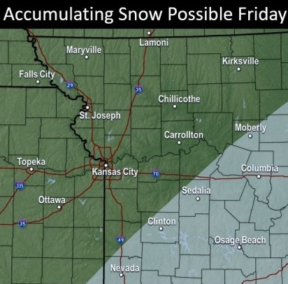
The National Weather Service said there are two chances for more snow in the next week, including Wednesday night into Thursday, and Thursday night into Friday. The Wednesday night event is likely to affect northeastern Kansas, while the Thursday night event is likely to be heavier in the Ozarks area.
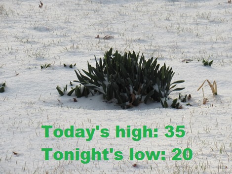
The temperature at 9 a.m. was 25 degrees in Wyandotte County, with a wind chill of 17, according to the weather service. Today’s high will reach 35, with tonight’s low at 20.
On Tuesday, temperatures will rebound to a high of about 47, the weather service said.
The Wednesday precipitation will likely begin with rain, then change to snow by midnight. A rain-snow mix will make a transition to snow by sunrise Thursday. More snow will be possible north of St. Joseph, Missouri, while the Kansas City area could receive mostly rain. Temperatures will be close to freezing.
On Thursday, chances are that more snow will accumulate in the Ozarks area than in the Kansas City area, but there is a 60 percent chance of precipitation in Wyandotte County. Temperatures will rise to 32 on Friday in Wyandotte County.
Today, it will be mostly sunny, with a high near 35 and a northwest wind of 7 to 13 mph, the weather service said. Gusts can be as high as 21 mph.
Tonight, it will be mostly clear, with a low of 20, and a light and variable wind, according to the weather service.
Tuesday, there will be increasing clouds, with a high near 47, the weather service said. A calm wind will become southeast 5 to 8 mph in the morning, with wind gusts as high as 18 mph.
Tuesday night, it will be partly cloudy, with a low of 27 and a south southwest wind around 5 mph becoming calm in the evening, according to the weather service.
Wednesday, there will be increasing clouds, a high near 49 and a calm wind becoming east northeast 5 to 9 mph in the morning, the weather service said.
Wednesday night, there is a 30 percent chance of rain before 1 a.m., then a chance of rain and snow between 1 a.m. and 4 a.m., then a chance of snow after 4 a.m. The low will be around 30. Less than a tenth of an inch of precipitation is possible.
Thursday, there is a 60 percent chance of rain and snow, then followed by all snow after 5 p.m., the weather service said. The high will be near 41.
Thursday night, there is a 60 percent chance of snow, mainly after midnight, according to the weather service. The low will be around 14.
Friday, there is a 40 percent chance of snow before noon, with a high near 32, the weather service said.
Friday night, it will be mostly clear, with a low of 9, according to the weather service.
Saturday, it will be sunny, with a high near 37, the weather service said.
Saturday night, it will be mostly clear, with a low of 23, according to the weather service.
Sunday, it will be sunny, with a high near 59, the weather service said.