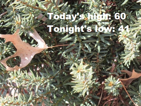
Today’s weather forecast will see cooler weather than the 80s seen on Wednesday, as the high will be about 60.
More see-saw temperatures, winds, rain, storms and snow all are in the forecast for the next five days.
Temperatures may rebound on Friday, and reach a high of 72, according to the National Weather Service forecast.
Then look for rain in the forecast on Saturday and Sunday, followed by a chance of snow on Sunday night and Monday, the weather service said.
Winds will gust up to 20 mph this afternoon, bringing a higher chance of fire weather, according to the weather service.
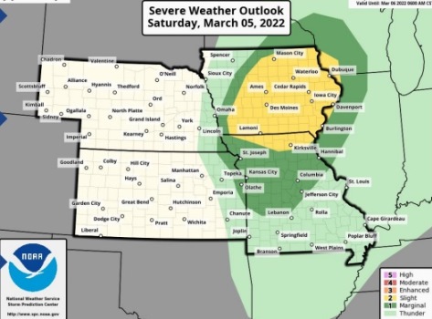
On Saturday, March 5, there will be a chance of severe weather from the late afternoon into the evening hours, the weather service said. This storm could have strong, damaging winds, frequent lightning and isolated pockets of hail, according to the weather service.
A cold front will move into the area after the Saturday storms, with rain and snow in the forecast Sunday night and Monday.
Today, it will be sunny, with a high near 60, the weather service said. An east wind of 10 to 14 mph will gust as high as 20 mph.
Tonight, it will be partly cloudy, with a low of 41 and an east wind of 10 to 13 mph, according to the weather service.
Friday, it will be partly sunny, with a high near 72 and a south wind of 10 to 18 mph, gusting as high as 28 mph, the weather service said.
Friday night, it will be mostly cloudy, then mostly clear, with a low of 57, according to the weather service. A south wind of 15 mph will gust as high as 22 mph.
Saturday, there is a 60 percent chance of rain, then rain is likely and possibly a thunderstorm after noon, the weather service said. The high will be near 71. A south wind of 16 to 22 mph will gust as high as 33 mph. Less than a tenth of an inch of rain is expected.
Saturday night, there is a 30 percent chance of rain and storms before 9 p.m., then a chance of rain between 9 p.m. and midnight. The low will be around 34. Less than a tenth of an inch of precipitation is expected.
Sunday, there is a 40 percent chance of rain after noon, with a high near 49, the weather service said.
Sunday night, there is a 50 percent chance of rain before 1 a.m., then a chance of rain and snow between 1 a.m. and 5 a.m., followed by a chance of snow after 5 a.m., according to the weather service. The low will be around 29.
Monday, there is a 30 percent chance of snow, mixing with rain after 11 a.m., then gradually ending, the weather service said. The high will be near 42.
Monday night, it will be mostly clear, with a low of 23, according to the weather service.
Tuesday, it will be sunny, with a high near 50, the weather service said.
Tuesday night, it will be mostly clear, with a low of 28, according to the weather service.
Wednesday, it will be mostly sunny, with a high near 54, the weather service said.