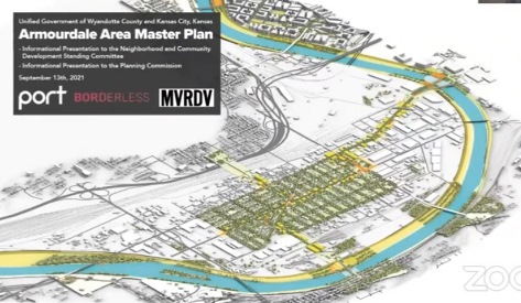
Fifty years after the devastating 1951 flood, a new Armourdale master plan will try to improve the neighborhoods next to the Kansas River on the southeast side of Kansas City, Kansas.
A public open house on the draft Armourdale master plan will be held from 3 p.m. to 7 p.m. today, Sept. 23.
The open house will be held at the Armourdale Community Center, 730 Osage Ave., Kansas City, Kansas.
The public may attend and offer comments on the draft area master plan.
The master plan also is online at https://www.armourdalestrong.com/master-plan-documents, and the public may comment at this website.
The Unified Government planning department staff has been meeting with groups and individuals in the Armourdale area during the past nine months to receive comments for the master plan. A steering committee has been working on the project.
The master plan was released this week, and will be a guide to future investment in the Armourdale community, according to UG officials. It is the first Armourdale master plan since 1979.
The Armourdale master plan was presented to the UG Neighborhood and Community Development Committee on Monday, Sept. 13, and also to the City Planning Commission on Sept. 13. Another presentation is scheduled to be given to the UG Commission Sept. 30.
According to UG officials, the 300-page master plan will go before the UG Commission at a later date, probably October, for final approval.
They would like to turn a cycle of decline into a cycle of prosperity, Gunnar Hand, UG planning director, told the NCD Committee on Sept. 13.
“The plan builds upon the work underway by the Unified Government to reimagine the Kansas River,” Hand stated in a news release. “Connecting this neighborhood to these investments will ensure this work benefits existing and future Armourdale residents and small business owners.”
“After a century of ambiguity,” Hand said in the statement, “this plan ensures that the existing residential community is sustainable and vibrant for the next generation.”
Andrew Moddrell, project consultant from Port Design, said at the Sept. 13 UG Committee meeting that the project now is moving into the final master plan phase.
Armourdale traces its history back to meatpacking plants and the stockyards. The entire Armourdale area is in a flood plain, and was devastated in the floods of 1903, 1908 and 1951, Moddrell said.
Some of the area’s past history included redlining, segregation and displacement that prevented development, according to Moddrell.
In the 1960s, everything in Armourdale east of 7th Street was cleared out after the flood, he said. New industrial development displaced about a third of the neighborhood.
Today, the Armourdale neighborhood core is surrounded by rivers, highways, and rail yards, he said. There are high productive industrial developments and low use, low land values, he said. Residential areas are surrounded by industrial uses.
The master plan found neglect of certain services such as lighting and sidewalks. Aging homes are about 50 percent renter-occupied and the Armourdale area has not seen new housing investment in a long time, he said.
The population of Armourdale has declined since the 1951 flood to where it is now about 2,500 residents, Moddrell said.
The master plan found that Armourdale is in many ways an isolated area, according to Moddrell. Health care is lacking. It has no grocery stores, but it does have a number of churches, grade schools, Cross-Lines and a county park. It lacks cultural amenities such as museums.
In some ways the master plan tries to strengthen the Armourdale community with community-led priorities such as access to fresh food and public spaces, according to officials.
Moddrell said at the Sept. 13 meeting that they would like to disrupt the cycle of disinvestment and isolation with a safe, empowered, included and accessible plan.
Reinvestment in the levee area in Armourdale, on the Kansas River, will mean better river access in the area, with potential for more development. There could be corridor enhancements linking to the Rock Island Bridge project area and other developments planned for the area, according to officials.
The master plan also looks at issues such as stormwater retention, bike lanes and trees.
Armourdale residents became part of the master plan consultant team, and workshops and surveys were conducted, Moddrell said. Some team members went door-to-door to talk to residents about the plan.
The levee projects and reinvestment in the river and perimeter of Armourdale, along with stormwater improvements, are expected to make a difference.
Five focus areas of the master plan included the neighborhood core; the corridors; the industrial ring; the Kansas River (or green machine); and the West Bottoms, Moddrell said.
Within each area are recommended actions. For the neighborhood core, for example, one strategy will be to support infill housing. Almost a dozen actions are recommended in the neighborhood core area.
The industrial recommendations are to try to phase out some lower uses, such as tire piles or pallet piles, he said. Also, the plan discusses how new development can be shaped to maintain pedestrian streets, add best practices, and improve stormwater retention to raise the overall value.
The plan also includes some ideas to connect corridor enhancements to the Kansas River, including through the Rock Island Bridge, walking trails and other features.
Commissioner Brian McKiernan remarked at the Sept. 13 committee meeting that it was a great road map, but the question was, can they follow the road map?
A video of the NCD Committee meeting is online at www.youtube.com/watch?v=2A4snbyOwgA.
.
