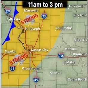

Strong to severe thunderstorms are expected to develop along a cold front this afternoon in the region.
According to the National Weather Service, the storms will begin just west of I-=35 and grow more organized as they push east of the Kansas City area.
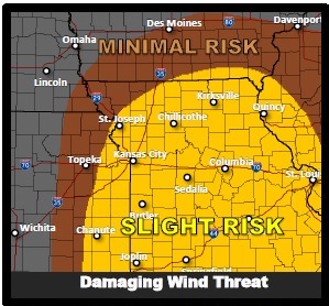
Large hail and damaging winds are the primary threats of the storm, the weather service said.
If clouds clear out more than expected, the atmosphere will become unstable and the severe threat may be higher.
Timing of the storm may change, but the latest data suggests that storms will develop earlier in the afternoon in the Kansas City area.
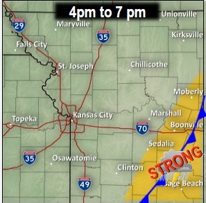
A strong front will race through the area and move into central Missouri by the evening hours.
There is a slight risk of large hail, a slight risk of damaging winds and a minimal risk of tornadoes with this storm.
The chance of thunderstorms today is 30 percent in Wyandotte County.
Temperatures at 8 a.m. Thursday were 55 degrees. The temperature may rise to 67.
Winds today will be 22 mph to 28 mph, with gusts as high as 39 mph.