Preliminary reports show no injuries in Wyandotte County from severe weather

Shortly after the tornado warning was over, some leaves and branches were seen in the road around 122nd and State Avenue in Wyandotte County.
The skies were very cloudy shortly after a tornado warning was lifted on Tuesday night near I-435 and Parallel Parkway in western Wyandotte County.
Clouds covered the skies in the area of South 78th and Kansas Avenue during a tornado warning on Tuesday night.

No injuries were reported in a severe storm on Tuesday night in Wyandotte County, according to a spokesman for the Unified Government.

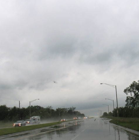
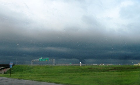
A tornado warning was issued and there were several reports of a tornado in western Wyandotte County, but questions as to whether it is officially a tornado. Based on preliminary reports, there was no significant damage or injuries, the spokesman said.

Power outages, uprooted and damaged trees and structural damage to buildings were reported in Bonner Springs and western Wyandotte County, according to the spokesman.

The Wyandotte County Emergency Management staff is expected to continue the damage assessment, with an updated report in the next few days, according to the spokesman. Emergency Management staff is continuing to monitor the storm throughout the night, as the risk continued for a severe thunderstorm.

The tornado warning was called off around 7:42 p.m. Tuesday. The UG spokesman stated that based on preliminary damage reports, the areas in Wyandotte County that were most affected were Bonner Springs and western Wyandotte County.

Outside of Wyandotte County, a tornado was reported in Douglas County, Kansas, where some homes were damaged and there were several injuries. Additional damage was reported in Leavenworth County.

Wyandotte County remains under a flash flood watch through 12:45 a.m. Wednesday, and a tornado watch through 10 p.m. Tuesday.

More weather information is at www.weather.gov.

Flash flood warning in effect

A flash flood warning is in effect for Wyandotte County from 6:47 p.m. Tuesday, May 28, through 12:45 a.m. Wednesday, May 29, according to the National Weather Service.

Thunderstorms produced heavy rain across the area, with flash flooding possible, according to the weather service.

Bonner Springs, Edwardsville and Wyandotte County, along with surrounding areas, may experience flooding.

The weather service advised drivers to turn around and not try to cross flooded roads.

Residents living along streams and creeks should take precautions to protect life and property.

Tornado warning expires

A tornado warning for Wyandotte County has now expired, according to the National Weather Service.

The weather service said large hail and damaging winds still may occur with this storm. The severe thunderstorm warning remains in effect for Wyandotte County, and gusty winds are possible with the storm.

The tornado watch remains in effect until 10 p.m. for northeastern Kansas.