Spring brings 60-degree day, declining flood waters, heavy rain Thursday and fire danger Wednesday

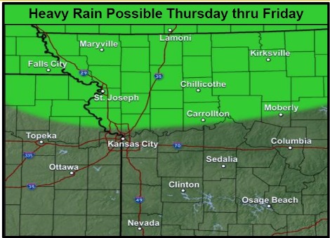
Heavy rain is possible throughout the region on Thursday and Friday, according to the National Weather Service. (National Weather Service graphic)
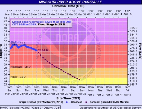
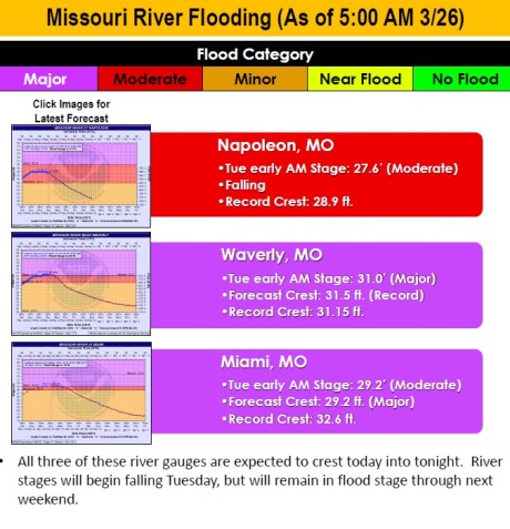
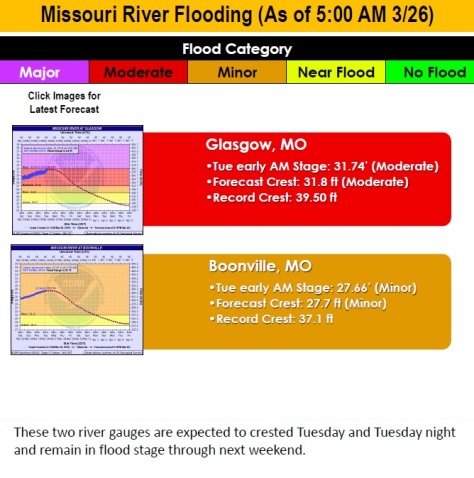
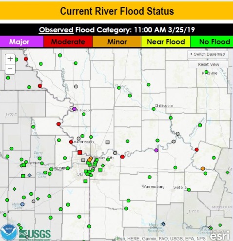
Current flooding along the Missouri River. (National Weather Service – USGS graphic)
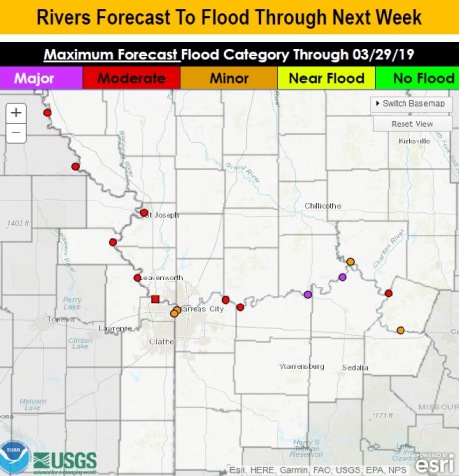
Flood forecast through next week. (National Weather Service – USGS graphic)

A beautiful spring day is in store for Wyandotte County today, as the weather forecast also details the continuing moderate Missouri River flooding and the heavy rain predicted Thursday and Friday.

Today’s high will be about 60 with mostly sunny skies, according to the National Weather Service.

Wyandotte County remains in moderate flood stage along the Missouri River, with the river levels declining a little today, according to the weather service. The flood warnings are at the moderate level along the river in Wyandotte County. On the east side of Wyandotte County, the Missouri River at Kansas City near the downtown Kansas City, Missouri, airport is in the minor flood stage, and the Kansas River at Kansas Avenue and the state line is in minor flood stage.

A heavy rain on Thursday and Friday over the region can aggravate the current river flooding, the weather service stated.

In addition, Wednesday will be windy and dry, with an elevated fire threat in the area, the weather service said.

Today, it will be mostly sunny with a high near 60 and a light and variable wind becoming southeast around 5 mph in the afternoon, the weather service said.

Tonight, it will be mostly clear, with a low of 45 and a south southeast wind of 6 to 8 mph, according to the weather service.

Wednesday, it will be mostly sunny with a high near 70, the weather service said. A south wind of 8 to 13 mph will increase to 16 to 21 mph in the afternoon, gusting as high as 36 mph.

Wednesday night, there is a 20 percent chance of showers after 1 a.m., with a low of 54, according to the weather service. A south southwest wind of 11 to 16 mph will gust as high as 24 mph.

Thursday, there is an 80 percent chance of precipitation, with showers and thunderstorms before 10 a.m., showers between 10 a.m. and 1 p.m., and then showers and possibly a thunderstorm after 1 p.m., the weather service said. The high will be 68 with a south southwest wind of 8 to 10 mph. Between a tenth and quarter-inch of rain is possible here.

Thursday night, there is a 70 percent chance of showers and possibly a thunderstorm, with a low of 53, according to the weather service. Between a quarter and half-inch of rain is possible.

Friday, there is a 90 percent chance of showers, with a high near 64, the weather service said.

Friday night, there is a 90 percent chance of showers and possibly a thunderstorm before 1 a.m., according to the weather service. The low will be around 38.

Saturday, it will be mostly cloudy with a high near 45, the weather service said.

Saturday night, it will be mostly clear, with a low of 26, according to the weather service.

Sunday, it will be sunny with a high near 48, the weather service said.

Sunday night, it will be mostly clear, with a low of 33, according to the weather service.

Monday, it will be mostly sunny, with a high near 55, the weather service said.
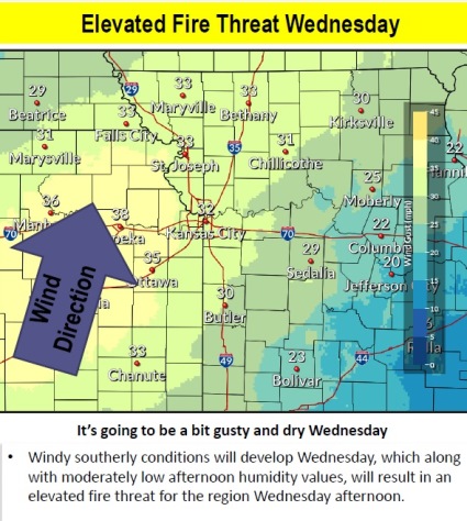
Fire threat on Wednesday. (National Weather Service graphic)
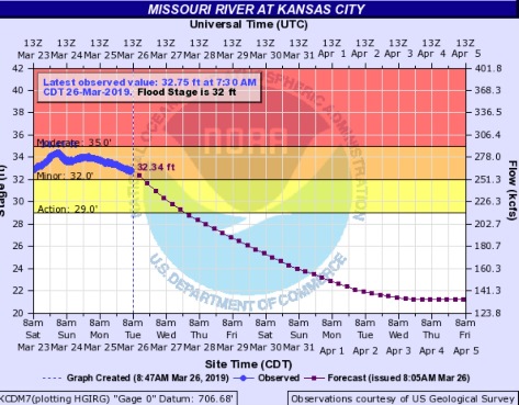
A hydrology chart for the Missouri River at Parkville, including Wyandotte County, showed Missouri River moderate levels expected to decline today. (National Weather Service – USGS graphic)
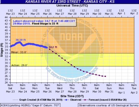
A hydrology chart for the Missouri River at Kansas City, where the gauge is located south of the downtown Kansas City, Missouri, airport, showed minor flood stage projected to decline today. (National Weather Service – USGS graphic)
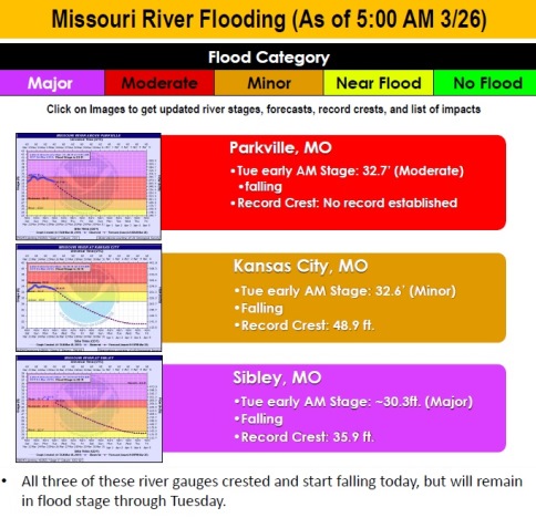
A hydrology chart for the Kansas River at 23rd Street, where the gauge is at Kansas Avenue and the state line, showed minor flood stage that is projected to decline today. (National Weather Service – USGS graphic)
National Weather Service graphic

Flood waters could remain in fields here a little longer

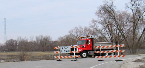
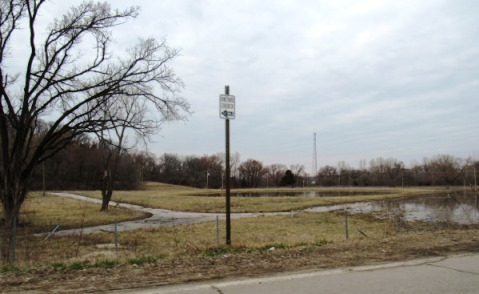
K-5 at Hutton Road was closed to through traffic because of flooding on Monday evening. Wolcott Drive is about a block north of this road closure sign, and that street, which is also K-5, is closed to 107th. The former Thunderlake Speedway, 5501 Wolcott Drive, a former go-kart track to the left, has flooded. The go-kart track has been closed for some years. Lakeside Speedway at 5615 Wolcott Drive flooded on Saturday, along with some other businesses on Wolcott Drive.
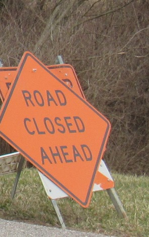
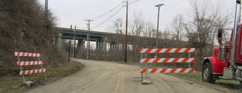
A road closed sign at 93rd Street, east of I-435.

Flood waters from the Missouri River could remain in Wyandotte County fields a little longer, as water releases have been stepped up from reservoirs upstream and rain is in the forecast for Kansas City and the river basin area.

With melted snow upstream entering the Missouri River basin area, the reservoirs upstream will be releasing more water into the river, according to Corps of Engineers officials.

The Corps of Engineers is stepping up water releases from the Gavins Point dam in South Dakota to 27,000 cubic feet per second today, and 30,000 cubic feet per second on Tuesday, Wednesday and Thursday, according to officials at a news conference today. This plan was changed from Sunday’s announcement.

There is currently major flooding on the James River upstream in the Dakotas, and water from the James and the Big Sioux rivers have an effect on the Missouri River.

A strong storm system is currently in the weather forecast from Thursday through Sunday, according to a National Weather Service forecaster.

About 1.5 inches of rain is expected to fall across northeast Kansas and northern Missouri, as well as some additional rainfall to the north.

If the rain falls as expected, some cities could receive 1.5 to 3 feet rises in the river, and the Missouri River at St. Joseph, Missouri, could rise 5 feet on Monday, according to the forecaster.

Thursday’s projected rain amounts will not show up in the National Weather Service river level forecasts until Tuesday, according to the National Weather Service forecaster, as there are only two days of anticipated precipitation included in each river level forecast. By Friday evening, the entire storm should be included in the river level forecasts, he said.

By the weekend, Corps officials and forecasters believe that the rivers will be substantially lower than they crested this past weekend. When the rivers rise next Monday, the main effect is that water will be on the levees for a longer time, according to Corps officials. With the longer time, the levees could become more susceptible to issues such as seepage or sand boils, according to officials.

To check on roads affected by flooding, visit KanDrive.org at http://www.kandrive.org/kandrive/roads/#construction/K-5/-96.0040/38.7201/7.

The former Thunderlake Speedway at Hutton Road and K-5 has flooded. The former go-kart track has not been open for several years.
Another view of the former Thunderlake Speedway at Hutton Road and K-5.
Another road that was closed was 93rd Street near Wolcott Road.
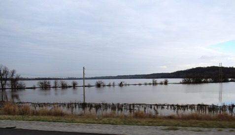
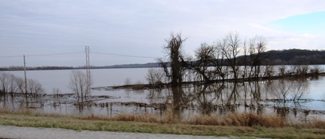
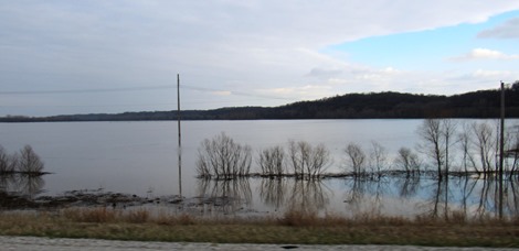
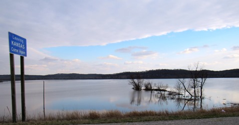
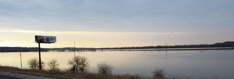
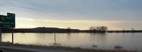
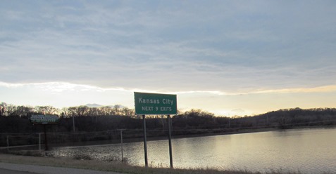
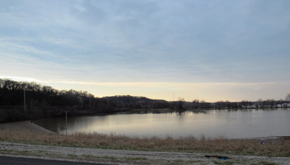
Fields to the east of I-435 in Wyandotte County were flooded on Monday evening. The flooding occurred on Saturday.
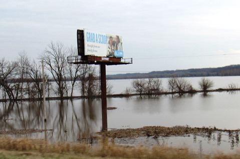
A billboard in a flooded field next to I-435 in Wyandotte County reads, “Grab a scoop.”
More flooded fields along I-435 in Wyandotte County were seen on Monday evening.
Flood waters covered fields next to I-435 in Wyandotte County on Monday evening.
Flooded fields next to I-435 in Wyandotte County on Monday evening.
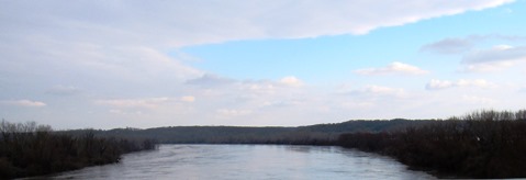
The Missouri River, looking east, on Monday evening.
Flooded fields to the west of I-435 in Wyandotte County on Monday evening.

Bonner Springs family makes custom knives

A Bonner Springs couple, Kevin and Cindy Scott, showed their custom-made knives at a gun and knife show on the weekend in Kansas City, Missouri. (Photo by William Crum)

by William Crum

One of the many things that makes Wyandotte County unique is the people and what they do.

One company that is based in Bonner Springs, Kansas, is called Scott’s Custom Knives.

Kevin Scott has been making knives for well over 15 years. Cindy Scott also makes knives for the company.

They have received numerous awards for craftsmanship. They’re located in Bonner Springs, Kansas.

On March 23 and 24, they were at a gun and knife show held at the KCI Expo Center in Kansas City, Missouri.

After talking to Scott, I learned a lot of what true craftsmanship really is. I was impressed. In my personal opinion, if you want custom knives this is the place to go.

Scott’s Custom Knives has a website at www.scottscustomknives.com.