Snow, low visibility reported

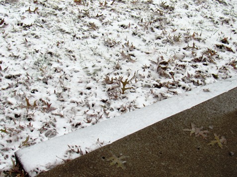
Snow was beginning to accumulate, as temperatures were dropping on Sunday in Kansas City, Kansas.
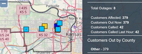
The Board of Public Utilities outage map reported 379 customers without power as of 12:35 p.m. Sunday.

Wyandotte County currently is in the throes of a blizzard with snow falling, blowing snow, low visibility and winds gusting to 29 mph.

Snow is beginning to cover the roadways, and conditions can be slick.

The temperature at noon Sunday was 34 degrees, with a wind chill of 23.

The Board of Public Utilities reported 379 persons without power in Kansas City, Kansas, as of 12:35 p.m. Sunday. There were 645 customers without power in Kansas City, Kansas, as of 1:15 p.m.

The National Weather Service was predicting 4 to 8 inches of snow possible. The weather service advised residents not to travel.

Gov. Jeff Colyer declared a state of disaster emergency in Kansas. State officials recommended delaying travel plans.

Multiple road closures were reported in Kansas. I-70 has been closed from Junction City, Kansas, to WaKeeney, Kansas, because of low visibility. For a list of road closures, visit http://kandrive.org.

Accidents were reported on Sunday at I-435 near Donahoo Road and on I-635 near K-5 in Wyandotte County.
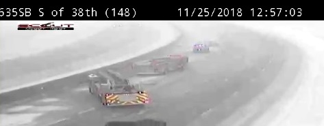
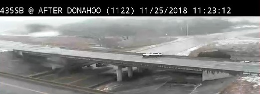
An accident was reported at 12:49 p.m. Sunday on southbound I-635 near 38th Street, according to KC Scout, with two left lanes closed. (KC Scout photo)

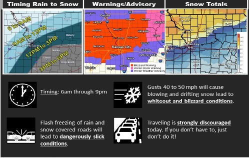
Blizzard warning in effect today

National Weather Service graphic

Wyandotte County remains under a blizzard warning from 9 a.m. Sunday through 9 p.m. Sunday, Nov. 25, according to the National Weather Service.

Winter weather conditions including falling and blowing snow, and strong winds are expected today, the weather service said.

Rain is likely before 10 a.m. in Wyandotte County, then rain and snow between 10 a.m.and 11 a.m., followed by snow after 11 a.m., according to the weather service. The snow could be heavy at times. Patchy blowing snow is possible after noon, the weather service said.

Temperatures may fall to 28 by 5 p.m., and it will be breezy, with a north wind of 18 to 26 mph, gusting as high as 50 mph, according to the weather service.

Total daytime snow accumulation of 4 to 8 inches is possible, the weather service said.

The weather service is asking residents not to travel today, but to wait until Monday.

Several church services and events today in Wyandotte County are canceled – check before you leave.

Tonight, there is a 30 percent chance of snow before 9 p.m., with patchy blowing snow before 10 p.m., according to the weather service. It will gradually clear, with a low of 17. A northwest wind of 18 to 23 mph will decrease to 10 to 15 mph after midnight, gusting as high as 46 mph.

Monday will be sunny with a high near 29 and a northwest wind of 6 to 9 mph, the weather service said.

For more weather information, visit www.weather.gov.